THE PROAERIAL MEDIA BLOG
What Is An Orthomosaic Map? (Answered in under 100 words)
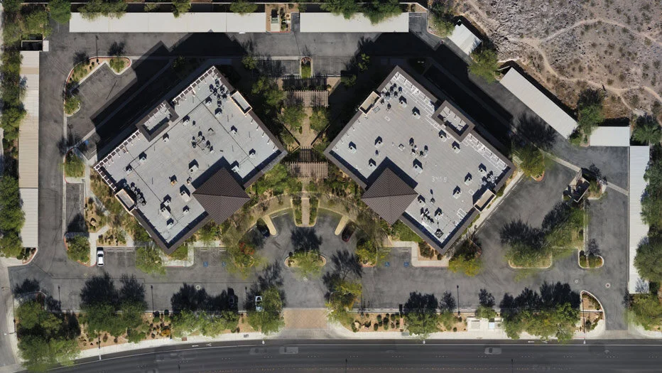
An Orthomosaic Map is an aerial photograph comprised of dozens, hundreds, or thousands of smaller overlapping images, typically captured with a drone or UAV. These images are “stitched together” with specialized photogrammetry software resulting in an Orthomosaic Image that has been “orthorectified” or geometrically corrected to provide uniform scale throughout allowing for accurate measurement of distance.