EXPLORE OUR REALITY CAPTURE SERVICES
AERIAL & TERRESTRIAL REALITY CAPTURE & PHOTOGRAMMETRY
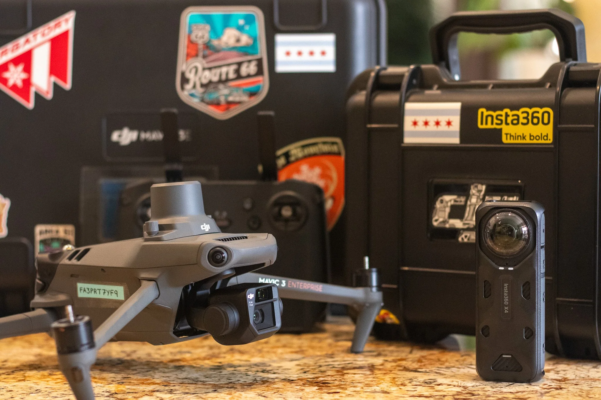
ProAerial Media (PAM) uses advanced technology for capturing real-world data. We provide aerial mapping and surveying, inspections, progress tracking, accurate volumetric measurements, as well as aerial photography and videography using top tools from DJI™, Insta360™, DroneDeploy™, and Propeller™.
If you don’t see what you’re looking for, please contact us directly to discuss custom requests.
Most Requested Services
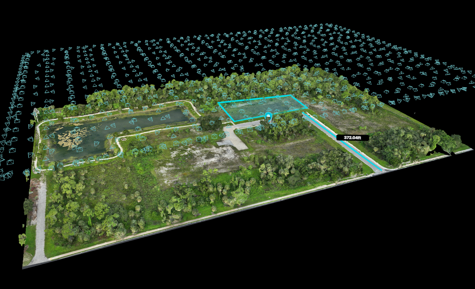
RTK Drone Mapping & Surveying
RTK drone mapping and surveying offer highly precise, real-time positioning and volumetric data that significantly enhances both accuracy and efficiency in a wide range of geospatial projects.

Construction Progress Monitoring
Reality capture technology provides accurate, detailed, and up-to-date visual data that allows stakeholders to monitor construction site progress efficiently and make informed decisions in real time.
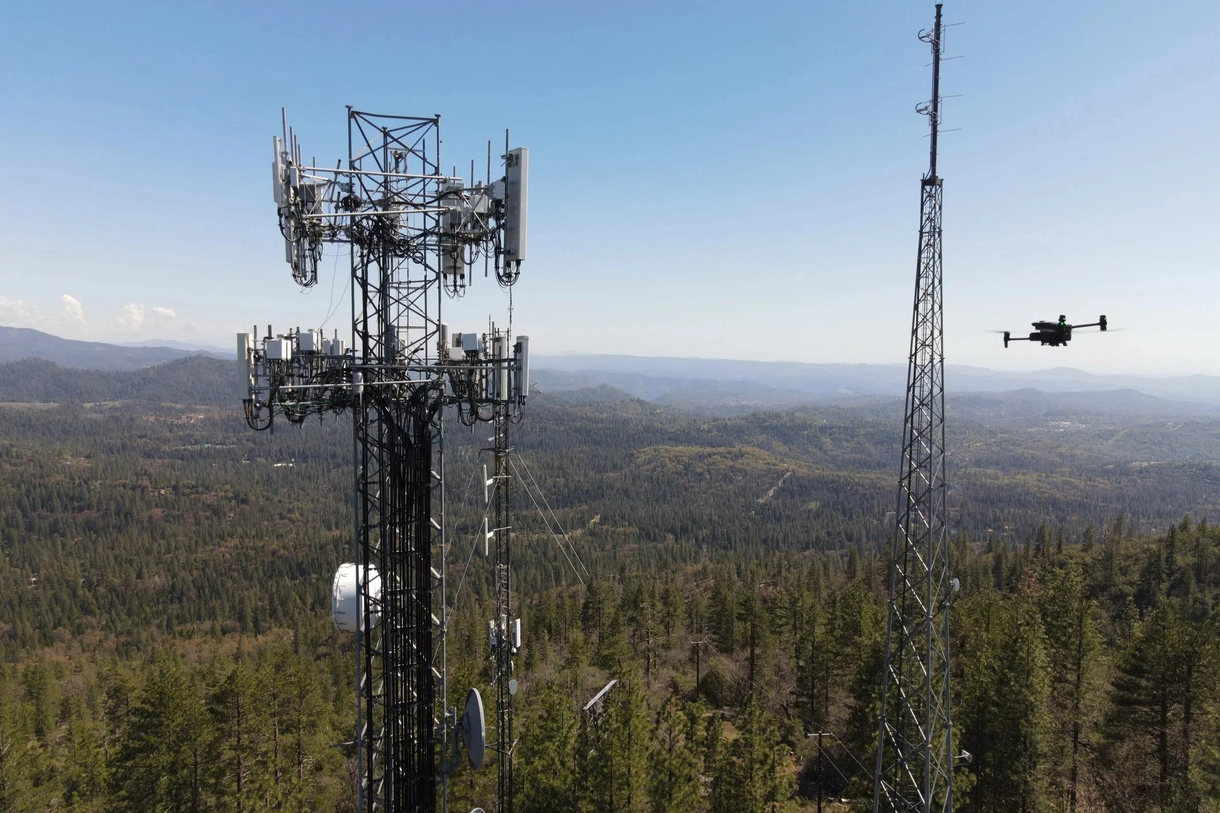
Building & Infrastructure Inspection Services
Reality capture leverages advanced aerial imaging technology to provide precise and efficient inspections of buildings and critical infrastructure. This approach enhances accuracy and safety while significantly reducing the time and resources typically required for thorough assessments.

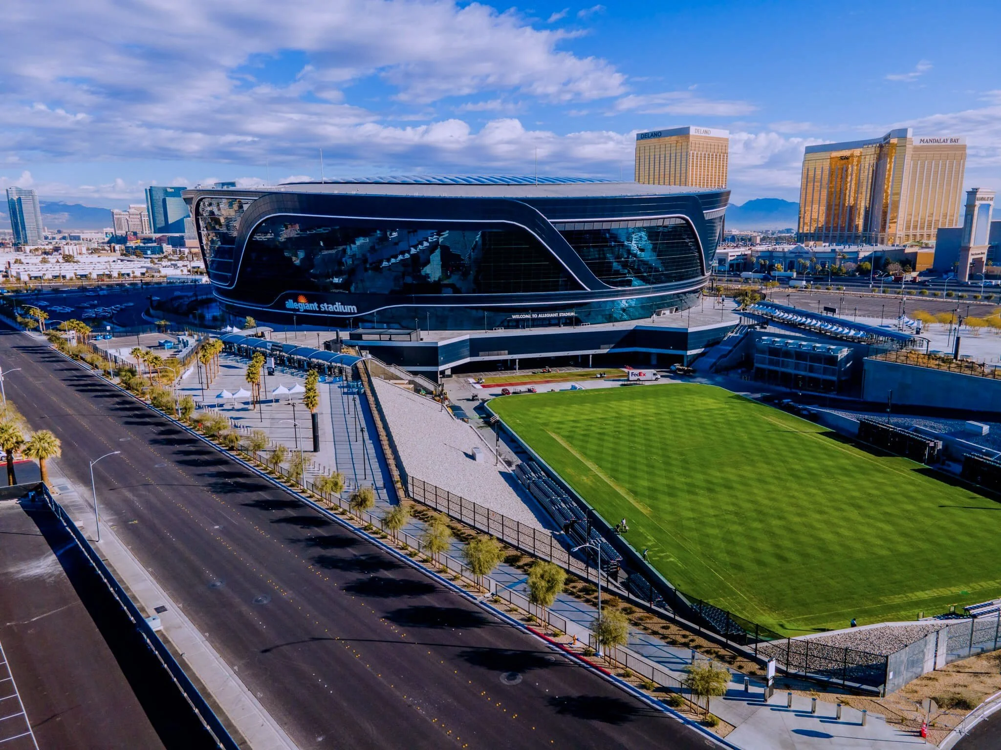
Aerial Photography & Videography
ProAerial Media provides aerial photo and video services using drones to capture clear images and videos for construction, real estate, and environmental projects.

360º Virtual Tours & Inspections
360 tours and inspections significantly enhance real estate and construction projects by offering comprehensive, immersive views that improve accuracy, facilitate detailed remote assessments, and accelerate informed decision-making processes for all stakeholders involved.

Enterprise sUAS Program Consutling
We help businesses set up and improve their own drone programs by offering expert advice on rules, planning, choosing equipment, and staff training for safe and efficient use.
Additional Services

Historical & Cultural Site Preservation
Reality capture allows for the preservation of historical sites and natural habitats, helping protect them by offering clear and complete information. This data supports better decisions and helps care for these sensitive areas over time.

Weddings & Special Events
Using drone photos for events or weddings provides a unique and captivating perspective that beautifully showcases the full scale and intricate details of the venue. This aerial view showcases the event's grandeur and creates striking, memorable content.
Services List (Sampling)
Residential Real Estate Aerial Photography
Commercial Real Estate Aerial Photography
Industrial Real Estate Aerial Photography
Rural Land Real Estate Aerial Photography
Aerial Photogrammetry Services
Solar Infrastructure Thermal Inspection Services
Insurance & Roof Inspections
Residential Real Estate Aerial Videography
Commercial Real Estate Aerial Videography
Industrial Real Estate Aerial Videography
Rural Land Real Estate Aerial Videography
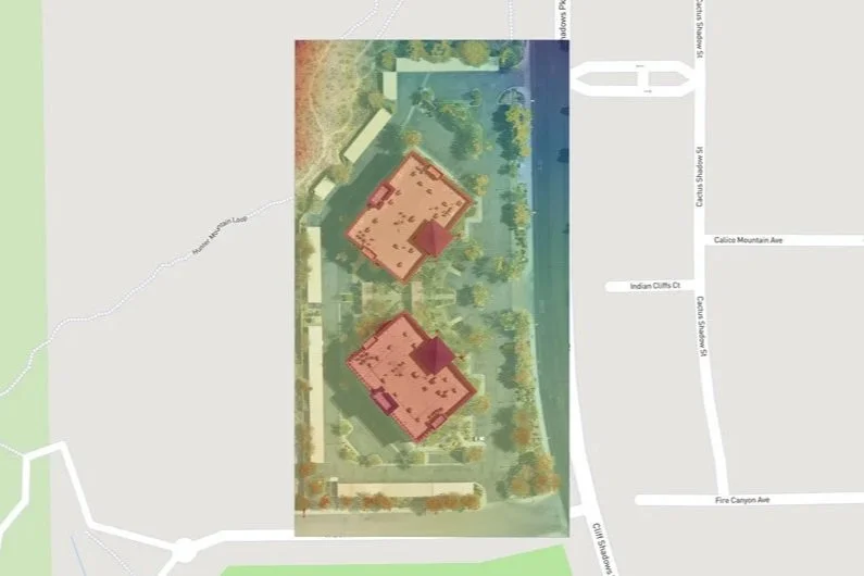
Drone Mapping, Surveying, & 3D Modeling
Construction Site Progress Monitoring/BIM
Remote Pilot Training
Recent Project:
Client: OVRWatch
Site: Cortland Alameda Station, Denver, CO
Assignment: Aerial & Terrestrial—Exterior & Interior Data Acquisition of a Multi-Family Apartment Complex

Sample Image Galleries
Click on any image to open the Adobe Lightroom Gallery in a new window/tab.

Rural Land Real Estate Aerial Photography

Construction Aerial Photography

Commercial Real Estate Aerial Photography
Industries Served

Agriculture
Construction
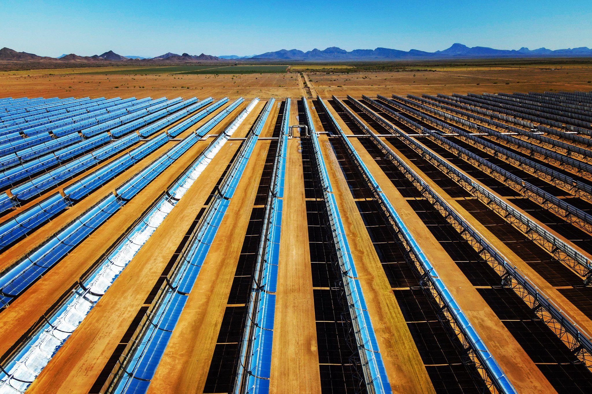
Renewable Energy

Mining

Real Estate

Special Events
Flight Options
Night Flights Now Available!
Departing from Sunset to Sunrise
ProAerial Media posses a CFR Part 107.29 Daylight Operation Waiver from the FAA enabling us to conduct flights at night. There are additional safety measures that must be taken for safety and to remain in compliance. If you require a nighttime flight, contact us to learn more.

Sunset on Route 66 in Mohave County Arizona, between Oatman and Topock.
Image Licensing Options
Extended Commercial Use
This license option grants the purchaser the right to use any of the final edited images for the lifetime of the listing (for Realtors and Agents), or for as long as you own the property (for Self-Listers like Airbnb or VRBO)
Excludes original data files.
PAM retains the original copyright on any images captured and reserves the right to use those images for the marketing and promotion of its business.
Unlimited Personal Use
This license grants the purchaser unlimited personal usage rights of the final captured and/or edited images.
Includes original data files.
PAM retains the original copyright on any images captured and reserves the right to use those images for the marketing and promotion of its business.
Exclusive Copyright
With this option, PAM will relinquish all rights, and grant the purchaser the exclusive copyright to any and all images captured during their flight(s), for any and all use.
Includes original data files.