REAL ESTATE DRONE SERVICES
Drone Aerial Imaging Services for REal Estate
We understand that selling real estate is a lot more work than simply putting a sign in the front yard. You need to have a listing that stands out in the crowd. You need aerial photographs. You need aerial video. And you need drone maps to have the best listing.
ProAerial Media provides a variety of image acquisition services for Real Estate Marketing, below you’ll find an overview of the types of services we offer Real Estate Professionals and Self-Listers alike, as well as some of our custom R/E Marketing Packages.
Types of Real Estate Aerial Photography Services

Residential
Residential Real Estate
Aerial and terrestrial photography and video services for residential properties.

Commercial
Commercial Real Estate
Aerial and terrestrial photography and video services for commercial properties.

RURAL
Rural/Undeveloped Land
Aerial and terrestrial photography and video services for rural and undeveloped land listings.

Industrial
Industrial Real Estate
Aerial and terrestrial photography and video services for industrial properties.
How To Market Rural Land
Land investors know that in order to sell their property it needs to be seen, but often buyers are across the country or properties are too remote to easily reach. Real Estate Marketing Videos can allow your potential buyer to tour the property with nothing more than a phone and in internet connection.
Learn how to sell rural vacant land with aerial photography and video.
Rural Land Marketing Packages

standard package
Standard
• 15–30 Aerial Photographs
• 20–30 Terrestrial Photographs
• Includes Basic Color Correction
from: $150*

ADVANCED Package
Advanced
• Everything in Standard
+ Drive Video (**approaching prop.)
+ Aerial Video (various)
+ Edited YouTube Video (:60–:180)
from: $375*

PROFESSIONAL Package
Professional
• Everything in Advanced
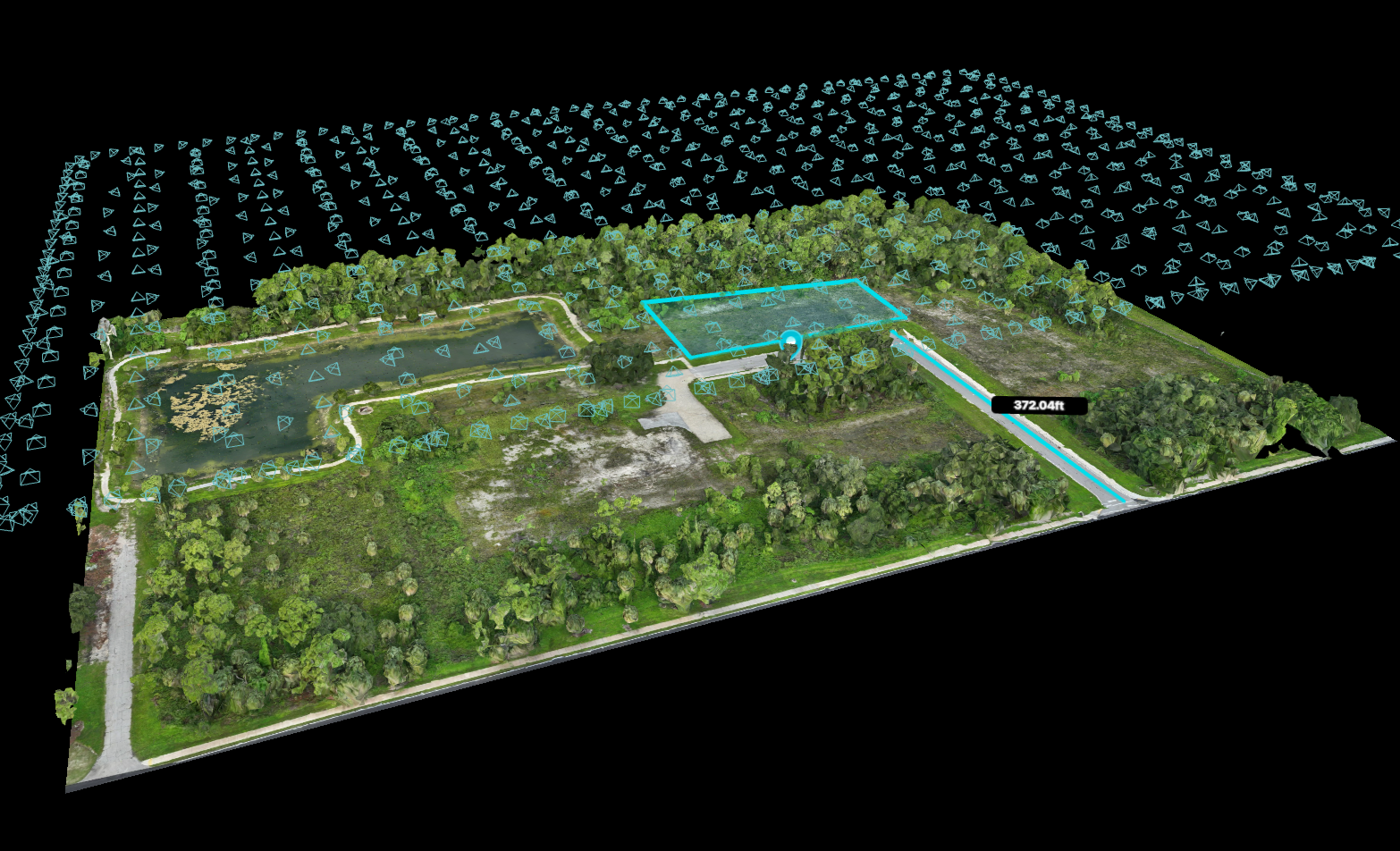
+ Mapping Flight (***up to 5 acres)
+ Orthomosaic Map (with property lines and measurements)
+ Additional Pix4D Outputs and web-access billed separately
from: $750*
*For flights operating during standard daytime hours. Travel fees not included.
**Drive Video consists of the final 5–7 minutes of drive time approaching the property, captured with a GoPro mounted on a vehicle.
***Additional charges apply for properties exceeding five (5) acres. Additional acreage available for purchase in multiples of five (5) for $375.